
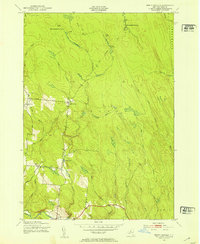
1944 Map of Point Rock
USGS Topo · Published 1944About this map
East Branch Fish Creek defines the local economy and topography of this 1944 landscape, where the War Department documented a series of industrial and agricultural sites along the waterways. The presence of Swancott Mill, Freeman Mill, Parson Mill, and Fey Mill indicates a history of water-powered production, likely serving the nearby community of Point Rock and the Prussian Settlement to the east. The map captures a high density of rural institutions, including St Ann Ch and several numbered schoolhouses like Sch No 8 and School No 6 that served the dispersed population across the Lewis and Oneida County line.
Find a feature on this map
54 named features on this map. Tap any name to fly to it.
Don’t see what you’re looking for? This feature index may not catch every label — zoom into the map to look around manually.
Map Details
Editions of this 1944 Point Rock Map
This is the sole edition of this map. No revisions or reprints were ever made.
Other maps of this area

1904 · Boonville
USGS Topo · 1:62,500

1905 · Port Leyden
USGS Topo · 1:62,500

1905 · Taberg
USGS Topo · 1:62,500

1906 · Highmarket
USGS Topo · 1:62,500

1907 · Port Leyden
USGS Topo · 1:62,500

1940 · Port Leyden
USGS Topo · 1:62,500

1943 · East Florence
USGS Topo · 1:31,680

1943 · Camden East
USGS Topo · 1:31,680

1943 · Lee Center
USGS Topo · 1:31,680
1943 · North Osceola
USGS Topo · 1:24,000