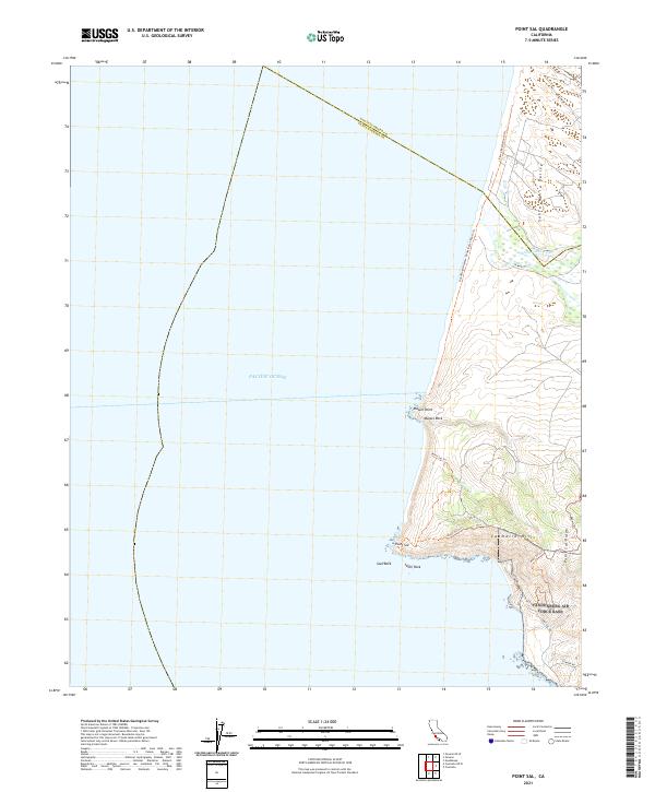
2021 Map of Point Sal
USGS Topo · Published 2021About this map
Point Sal and the dramatic coastal bluffs of northern Santa Barbara County define this landscape, where the Pacific Ocean meets the western edge of the Casmalia Hills. This 2021 survey details a rugged interface of land and sea, focusing on the prominent headlands of Mussel Point and the namesake Point Sal. Inland, the terrain rises sharply toward Point Sal Ridge, overlooking the southern reach of the Santa Maria Valley and the mouth of the Santa Maria River. The map documents a network of coastal access routes, including the Guadalupe-Nipomo Dunes Beach Route Trl and the Point Sal Trl, which navigate the steep topography. Significant offshore landmarks like Mussel Rock, Seal Rock, and Lion Rock are carefully noted, providing essential navigational data for this reach of the California coast.
Find a feature on this map
25 named features on this map. Tap any name to fly to it.
Don’t see what you’re looking for? This feature index may not catch every label — zoom into the map to look around manually.
Map Details
Editions of this 2021 Point Sal Map
This is the sole edition of this map. No revisions or reprints were ever made.
Other maps of this area

1897 · Port Harford
USGS Topo · 1:62,500

1897 · Arroyo Grande
USGS Topo · 1:62,500

1900 · San Luis
USGS Topo · 1:125,000

1905 · Guadalupe
USGS Topo · 1:125,000

1941 · Port San Luis
USGS Topo · 1:62,500

1942 · Guadalupe
USGS Topo · 1:125,000

1942 · Arroyo Grande
USGS Topo · 1:62,500

1942 · Point Sal
USGS Topo · 1:62,500
1945 · Port San Luis
USGS Topo · 1:62,500
1947 · Casmalia
USGS Topo · 1:24,000