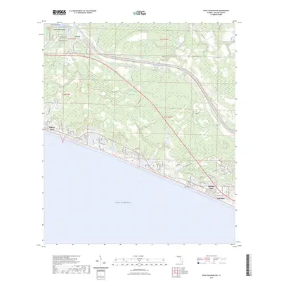
2024 Map of Point Washington
USGS Topo · Published 2024About this map
Point Washington and the surrounding shoreline of Choctawhatchee Bay define this Walton County landscape, where the sheltered waters of Tucker Bayou meet the sprawling Point Washington State Forest. The map documents a contemporary coastal environment shaped by the Intracoastal Waterway and the dense wetlands of Devils Swamp. Along the southern edge, a string of planned communities including Seagrove Beach, Alys Beach, and Rosemary Beach line the Gulf of Mexico, separated from the northern bayous by miles of protected forest and the Flatwoods Forest Loop. Local heritage is preserved at sites like Wesley Cem and the Point Washington Community Cem, while the historic character of the region remains visible in the transition from the bay-side settlement at Choctaw to the modern beach developments and the preserved grounds of Eden Gardens State Park.
Find a feature on this map
88 named features on this map. Tap any name to fly to it.
Don’t see what you’re looking for? This feature index may not catch every label — zoom into the map to look around manually.
Map Details
Editions of this 2024 Point Washington Map
This is the sole edition of this map. No revisions or reprints were ever made.
Other maps of this area

1936 · Point Washington
USGS Topo · 1:48,000

1939 · Point Washington
USGS Topo · 1:62,500

1943 · Laguna Beach
USGS Topo · 1:31,680

1943 · Seminole Hills
USGS Topo · 1:24,000

1944 · Seminole Hills
USGS Topo · 1:31,680

1944 · Bruce
USGS Topo · 1:24,000

1945 · Bruce
USGS Topo · 1:31,680

1954 · Tallahassee
USGS Topo · 1:250,000

1957 · Pensacola
USGS Topo · 1:250,000

1959 · Tallahassee
USGS Topo · 1:250,000