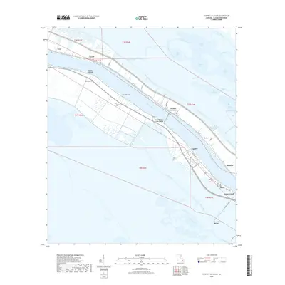
2018 Map of Pointe a la Hache
USGS Topo · Published 2018About this map
The Mississippi River carves a winding path through this portion of Plaquemines Parish, defining a landscape where narrow ribbons of habitable land are pressed between the river's levees and the expansive wetlands of the Mississippi Delta. In this 2018 survey, the parish seat of Pointe à la Hache remains connected to West Pointe A La Hache via the Pointe à la Hache Ferry, a vital transit link in a region dominated by water. The settlement pattern follows the high ground of the natural levees along HWY 15, where small communities like Woodland, Magnolia, and Diamond are clustered. This linear development is punctuated by numerous family and community burial grounds, including Ballowe Cem and Mange Cem, which provide significant genealogical touchstones for the area. Beyond the protection of the Back-Levee Canal, the geography dissolves into a complex network of bays and bayous such as Wreck Bay and Bell Bayou, illustrating the precarious balance of life on the edge of the Gulf.
Find a feature on this map
59 named features on this map. Tap any name to fly to it.
Don’t see what you’re looking for? This feature index may not catch every label — zoom into the map to look around manually.
Map Details
Editions of this 2018 Pointe a la Hache Map
This is the sole edition of this map. No revisions or reprints were ever made.
Other maps of this area

1891 · Pointe a La Hache
USGS Topo · 1:62,500

1892 · Quarantine
USGS Topo · 1:62,500

1892 · Pointe a La Hache
USGS Topo · 1:62,500

1893 · Fort Livingston
USGS Topo · 1:62,500

1893 · Dime
USGS Topo · 1:62,500

1935 · Port Sulphur
USGS Topo · 1:31,680

1935 · Lake Batola
USGS Topo · 1:31,680

1935 · Wilkinson Bay
USGS Topo · 1:31,680

1939 · Pointe a La Hache
USGS Topo · 1:62,500

1941 · Black Bay
USGS Topo · 1:62,500