2024 Map of Pointe a la Hache
USGS Topo · Published 2024About this map
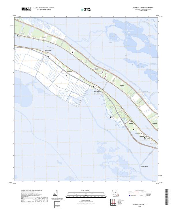
The Mississippi River carves a sharp southeast path through Plaquemines Parish in this 2024 survey, defining the thin ribbon of habitable land protected by the Buck Levee Canal and Back Levee Canal. This coastal landscape is dominated by small riverfront settlements and family-named cemeteries that speak to generations of habitation in the delta. Significant religious and community hubs like the Saint Thomas Catholic Church Cem and Point Celeste Cem sit just behind the levee, while the Pointe a la Hache Ferry remains a critical transit link between the east and west banks. The area's dependence on the water is evident in the infrastructure at Pointe a la Hache Boat Harbor and the industrial layout of Port Sulphur. Beyond the levees, the map reveals the complex hydrology of the marsh, where names like Bell Bayou and Wreck Bay signify the precarious boundary between the river's silt and the encroaching Gulf waters.
Find a feature on this map
59 named features on this map. Tap any name to fly to it.
Don’t see what you’re looking for? This feature index may not catch every label — zoom into the map to look around manually.
Map Details
Editions of this 2024 Pointe a la Hache Map
This is the sole edition of this map. No revisions or reprints were ever made.
Historical Maps of Magnolia Through Time
1 maps found