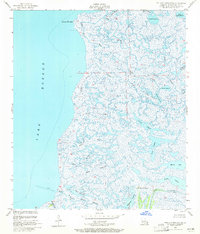
1955 Map of Pointe aux Marchettes
USGS Topo · Published 1965About this map
Saint Malo sits at the southwestern edge of this vast coastal marshland, where the solid ground of the Bayou La Loutre ridge meets the open waters of Lake Borgne. This mid-century survey details an intricate network of tidal waterways and brackish lagoons that defined the St. Bernard Parish interior before modern land loss accelerated. The southern portion of the sheet is dominated by the Spoil Bank along the historic Bayou La Loutre, a critical corridor for early settlement and navigation. Inland, the topography is almost entirely level, broken only by subtle rises like Magnolia Mound. From the northern Magill Lagoon to the southern Muscelini Bayou, the map preserves the complex drainage patterns of the Louisiana wetlands, including man-made features such as Jahvickers Ditch and the lighthouse Light guarding the approach to the Saint Malo area.
Find a feature on this map
34 named features on this map. Tap any name to fly to it.
Don’t see what you’re looking for? This feature index may not catch every label — zoom into the map to look around manually.
Map Details
Editions of this 1955 Pointe aux Marchettes Map
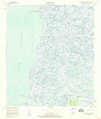
2 editions found
Other maps of this area

1893 · Rigolets
USGS Topo · 1:62,500

1893 · Shell Beach
USGS Topo · 1:62,500

1893 · Toulme
USGS Topo · 1:62,500

1895 · Bodreau
USGS Topo · 1:62,500

1936 · Rigolets
USGS Topo · 1:62,500

1939 · Shell Beach
USGS Topo · 1:62,500

1941 · Shell Beach
USGS Topo · 1:62,500

1946 · Lake Eugenie
USGS Topo · 1:31,680

1946 · Malheureux Point
USGS Topo · 1:31,680
1947 · Lake Eloi
USGS Topo · 1:31,680