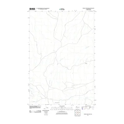
2011 Map of Poisel Butte SW
USGS Topo · Published 2011About this map
Onepennee Cemetery sits in an isolated position within the high, arid landscape of the Horse Heaven Hills on this 2011 survey of Yakima County. This area is defined by a sparse network of Bureau of Indian Affairs routes, including BIA 280 Rd and BIA 63 Rd, which traverse the undulating terrain and steep coulees. Drainage patterns are dominated by seasonal watercourses like Mule Dry Creek, which cuts a significant path through the center of the quadrangle, and Bull Creek to the southwest. The presence of Pine Creek Rd following the course of Pine Creek in the south illustrates the reliance on natural topographic corridors for transit in this part of Washington. The map serves as a record of land use and tribal infrastructure, focusing on the essential landmarks and road systems of the region.
Find a feature on this map
15 named features on this map. Tap any name to fly to it.
Don’t see what you’re looking for? This feature index may not catch every label — zoom into the map to look around manually.
Map Details
Editions of this 2011 Poisel Butte SW Map
This is the sole edition of this map. No revisions or reprints were ever made.
Other maps of this area

1910 · Zillah
USGS Topo · 1:125,000

1916 · Arlington
USGS Topo · 1:125,000

1937 · White Swan
USGS Topo · 1:125,000

1950 · Yakima
USGS Topo · 1:250,000

1953 · The Dalles
USGS Topo · 1:250,000

1956 · The Dalles
USGS Topo · 1:250,000

1957 · The Dalles
USGS Topo · 1:250,000

1957 · Satus Pass
USGS Topo · 1:62,500

1958 · Yakima
USGS Topo · 1:250,000

1961 · Yakima
USGS Topo · 1:250,000