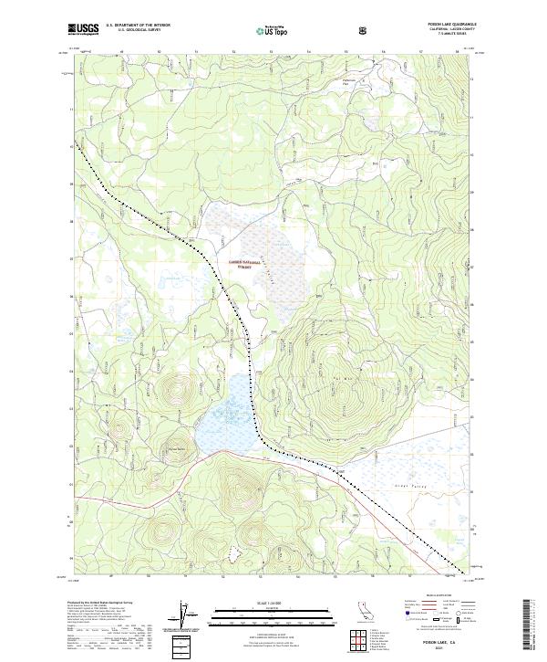
2021 Map of Poison Lake
USGS Topo · Published 2021About this map
Lassen National Forest terrain dominates this survey of the high plateau region in northern California. The landscape is defined by volcanic features and seasonally shifting water bodies, including the prominent Poison Lake and Poison Butte at the center of the sheet. Modern infrastructure is represented by Ca 44, which cuts through the southern half of the quadrangle near the Grays Flat area and Robbers Spring. The map reveals a network of forest service roads like Pittville Rd and Lodgepole, which provide access to more remote locations such as Patterson Flat and the cinder cones of Cone Mtn and Cal Mtn. The presence of Coyote Hale and several named reservoirs and lakes, such as Half Cabin Reservoir and Ebey Lake, underscores the importance of water management and livestock grazing in this timberland and volcanic basin environment.
Find a feature on this map
26 named features on this map. Tap any name to fly to it.
Don’t see what you’re looking for? This feature index may not catch every label — zoom into the map to look around manually.
Map Details
Editions of this 2021 Poison Lake Map
This is the sole edition of this map. No revisions or reprints were ever made.
Other maps of this area

1886 · Lassen Peak
USGS Topo · 1:250,000

1892 · Lassen Peak
USGS Topo · 1:250,000

1894 · Lassen Peak
USGS Topo · 1:250,000

1939 · Halls Flat
USGS Topo · 1:125,000

1955 · Westwood
USGS Topo · 1:250,000

1956 · Harvey Mtn
USGS Topo · 1:62,500

1957 · Prospect Peak
USGS Topo · 1:62,500

1957 · Little Valley
USGS Topo · 1:62,500

1957 · Jellico
USGS Topo · 1:62,500

1958 · Westwood
USGS Topo · 1:250,000