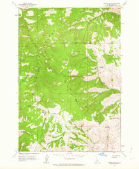
1962 Map of Poison Peak
USGS Topo · Published 1964About this map
Salmon National Forest dominates this high-elevation landscape in the early 1960s, a region defined by its steep drainages and strategic water sources. The map clearly delineates the Old Indian Treaty Boundary, which cuts across the high ridges between McDevitt Creek and Haynes Creek. This administrative line provides a historical reference for land use and territorial divisions within the Idaho wilderness.
Find a feature on this map
25 named features on this map. Tap any name to fly to it.
Don’t see what you’re looking for? This feature index may not catch every label — zoom into the map to look around manually.
Map Details
Editions of this 1962 Poison Peak Map
2 editions found
Other maps of this area

1950 · Salmon
USGS Topo · 1:62,500

1951 · Salmon
USGS Topo · 1:62,500

1955 · Dubois
USGS Topo · 1:250,000

1955 · Dillon
USGS Topo · 1:250,000

1956 · Goldstone Mtn
USGS Topo · 1:62,500

1956 · Lemhi
USGS Topo · 1:62,500

1957 · Dillon
USGS Topo · 1:250,000

1958 · Dubois
USGS Topo · 1:250,000

1958 · Dillon
USGS Topo · 1:250,000

1962 · Dillon
USGS Topo · 1:250,000