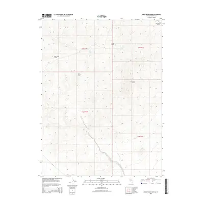
2014 Map of Poker Brown Spring
USGS Topo · Published 2014About this map
Trinity Range dominates this Pershing County landscape, where deep desert canyons and isolated water sources define the geography. The map detail highlights the vital importance of springs in this arid environment, specifically Poker Brown Spring and Trinity Spring, which historically served as critical stopovers for travelers and livestock through the high desert. The topography is deeply incised by major drainage systems including Poker Brown Canyon, Trinity Canyon, and South Trinity Canyon, which converge from the higher elevations. This 2014 survey documents the remote backcountry and traditional land divisions, providing a clear view of the Black Rock Canyon area and the rugged corridors that have long shaped navigation through the Nevada interior.
Find a feature on this map
11 named features on this map. Tap any name to fly to it.
Don’t see what you’re looking for? This feature index may not catch every label — zoom into the map to look around manually.
Map Details
Editions of this 2014 Poker Brown Spring Map
This is the sole edition of this map. No revisions or reprints were ever made.
Other maps of this area

1931 · Lovelock
USGS Topo · 1:250,000

1935 · Lovelock
USGS Topo · 1:250,000

1955 · Lovelock
USGS Topo · 1:250,000

1956 · Oreana
USGS Topo · 1:62,500

1956 · Toulon
USGS Topo · 1:62,500

1956 · Lovelock
USGS Topo · 1:62,500

1959 · Lovelock
USGS Topo · 1:250,000

1981 · Natchez Spring
USGS Topo · 1:24,000

1981 · Trinity Pass
USGS Topo · 1:24,000

1981 · Poker Brown Spring
USGS Topo · 1:24,000