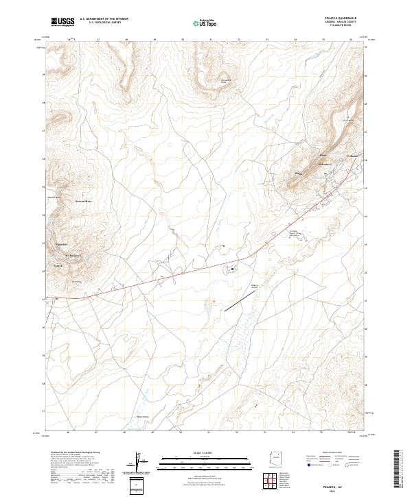
2021 Map of Polacca
USGS Topo · Published 2021About this map
Walpi and Sichomovi occupy the prominent heights of First Mesa on this modern survey of the Hopi Reservation. The landscape is defined by the sharp transition between the mesa tops and the lower basins of Wepo Valley. Settlements like Hano and Polacca are clustered near vital water sources such as Spider Spring and Coyote Spring, while Sipaulovi and Mishongnovi sit atop Second Mesa further west. Modern infrastructure, including the Northland Pioneer College Hopi Center and the Polacca Airport, serves the community alongside long-established villages. The map reveals the ancient logic of habitation in this high desert environment, where town locations are tied to the defensive topography of the mesas and the intermittent drainage of Wepo Wash and Polacca Wash.
Find a feature on this map
34 named features on this map. Tap any name to fly to it.
Don’t see what you’re looking for? This feature index may not catch every label — zoom into the map to look around manually.
Map Details
Editions of this 2021 Polacca Map
This is the sole edition of this map. No revisions or reprints were ever made.
Other maps of this area

1883 · Tusayan
USGS Topo · 1:250,000

1886 · Tusayan
USGS Topo · 1:250,000

1947 · Flagstaff
USGS Topo · 1:250,000

1954 · Flagstaff
USGS Topo · 1:250,000

1958 · Flagstaff
USGS Topo · 1:250,000

1960 · Flagstaff
USGS Topo · 1:250,000

1962 · Flagstaff
USGS Topo · 1:250,000

1966 · Oraibi
USGS Topo · 1:62,500

1966 · Egloffstein Butte
USGS Topo · 1:62,500

1966 · Tovar Mesa
USGS Topo · 1:62,500