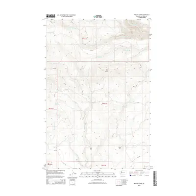
2014 Map of Poland Butte
USGS Topo · Published 2014About this map
Poland Butte and Oak Hill dominate this Yakima County landscape, which is defined by an intricate network of drainage systems and isolated springs. The terrain is marked by the presence of Mike Coon Hillside in the north and the quiet expanse of Cedar Valley toward the south. Water is the primary architect of the local geography, with the Toppenish Cr and its S Fork Toppenish Cr carving paths through the high country alongside Tepee Cr and White Deer Cr.
Find a feature on this map
28 named features on this map. Tap any name to fly to it.
Don’t see what you’re looking for? This feature index may not catch every label — zoom into the map to look around manually.
Map Details
Editions of this 2014 Poland Butte Map
This is the sole edition of this map. No revisions or reprints were ever made.
Other maps of this area

1904 · Mount Adams
USGS Topo · 1:125,000

1907 · Mount Adams
USGS Topo · 1:125,000

1937 · White Swan
USGS Topo · 1:125,000

1950 · Yakima
USGS Topo · 1:250,000
1957 · Willy Dick Canyon
USGS Topo · 1:24,000

1958 · Fort Simcoe
USGS Topo · 1:62,500

1958 · Yakima
USGS Topo · 1:250,000

1961 · Yakima
USGS Topo · 1:250,000
1965 · Hagerty Butte
USGS Topo · 1:24,000
1965 · Mc Kays Butte
USGS Topo · 1:24,000