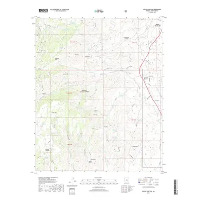
2018 Map of Poland Junction
USGS Topo · Published 2018About this map
Poland Junction and the surrounding high-desert terrain of the Prescott National Forest define this landscape, where mining and ranching history are etched into the topography. The map details a transition from the industrial heights of Smelter Hill and Mt Elliott down toward the drainage of Big Bug Creek. Evidence of early 20th-century engineering is visible in the Poland-Walker Tunnel, while numerous water sources like Hackberry Mine Spring and Postmaster Spring speak to the critical importance of water management in the Bradshaw Mountains. The settlement of Walker and the community of Dewey-Humboldt anchor the region's human geography, connected by historic routes such as Bannie Mine Rd and the Cat Walk. This survey illustrates how the rugged geography of Yavapai County dictated the placement of settlements and transport corridors between the canyons and mesas.
Find a feature on this map
90 named features on this map. Tap any name to fly to it.
Don’t see what you’re looking for? This feature index may not catch every label — zoom into the map to look around manually.
Map Details
Editions of this 2018 Poland Junction Map
This is the sole edition of this map. No revisions or reprints were ever made.
Other maps of this area

1887 · Prescott
USGS Topo · 1:250,000

1892 · Prescott
USGS Topo · 1:250,000

1903 · Bradshaw Mountains
USGS Topo · 1:125,000

1905 · Jerome
USGS Topo · 1:125,000

1944 · Mingus Mountain
USGS Topo · 1:62,500

1947 · Mingus Mtn
USGS Topo · 1:62,500

1947 · Mayer
USGS Topo · 1:62,500

1947 · Mt. Union
USGS Topo · 1:62,500

1947 · Prescott
USGS Topo · 1:62,500

1948 · Mt. Union
USGS Topo · 1:63,360