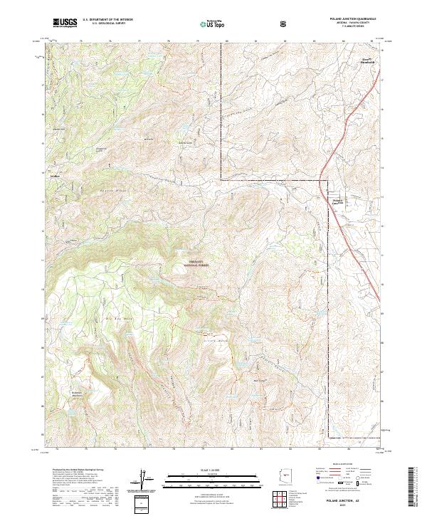
2021 Map of Poland Junction
USGS Topo · Published 2021About this map
Prescott National Forest dominates this section of the Bradshaw Mountains, where the historical mining legacy of Yavapai County is written across the steep drainages. The complex terrain is defined by significant ridges and canyons, most notably Eugene Ridge and the broad plateau of Big Bug Mesa. Evidence of early industrial activity remains through labels like the Bannie Mine and the notable Poland-Walker Tunnel, which once connected these remote mountain drainages.
Find a feature on this map
93 named features on this map. Tap any name to fly to it.
Don’t see what you’re looking for? This feature index may not catch every label — zoom into the map to look around manually.
Map Details
Editions of this 2021 Poland Junction Map
This is the sole edition of this map. No revisions or reprints were ever made.
Other maps of this area

1887 · Prescott
USGS Topo · 1:250,000

1892 · Prescott
USGS Topo · 1:250,000

1903 · Bradshaw Mountains
USGS Topo · 1:125,000

1905 · Jerome
USGS Topo · 1:125,000

1944 · Mingus Mountain
USGS Topo · 1:62,500

1947 · Mingus Mtn
USGS Topo · 1:62,500

1947 · Mayer
USGS Topo · 1:62,500

1947 · Mt. Union
USGS Topo · 1:62,500

1947 · Prescott
USGS Topo · 1:62,500

1948 · Mt. Union
USGS Topo · 1:63,360