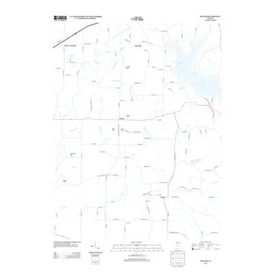
2013 Map of Poland
USGS Topo · Published 2013About this map
The Eel River and the extensive waters of Cagles Mill Lake define the geography of this Owen County landscape. The settlement of Poland sits centrally near Keiser Hill, serving as a focal point for a network of country roads connecting smaller locales like Raab Crossroads and Cagle Mill. The terrain is marked by numerous named rises and depressions, including Cromwell Hill, Drake Hill, and the distinct Owl Hollow.
Find a feature on this map
105 named features on this map. Tap any name to fly to it.
Don’t see what you’re looking for? This feature index may not catch every label — zoom into the map to look around manually.
Map Details
Editions of this 2013 Poland Map
This is the sole edition of this map. No revisions or reprints were ever made.
Other maps of this area

1908 · Clay City
USGS Topo · 1:48,000

1910 · Clay City
USGS Topo · 1:62,500

1950 · Brazil East
USGS Topo · 1:24,000

1952 · Reelsville
USGS Topo · 1:24,000

1953 · Indianapolis
USGS Topo · 1:250,000

1956 · Indianapolis
USGS Topo · 1:250,000

1956 · Cloverdale
USGS Topo · 1:24,000

1956 · Cataract
USGS Topo · 1:24,000

1956 · Patricksburg
USGS Topo · 1:24,000
1956 · Spencer
USGS Topo · 1:24,000