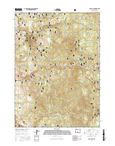
2017 Map of Pole Butte
USGS Topo · Published 2017About this map
Fremont National Forest defines this high-elevation landscape in Lake County, where water resources are the primary landmarks. High points like Pole Butte and Timber Fall Butte overlook a network of seasonal drainages and springs essential for forest management and local ecology. Named watering spots such as Box Spring, Log Spring, and Picketpin Spring dot the terrain, linked by an extensive network of fire roads including Natl Forest Develop Road 3119 Rd.
Find a feature on this map
29 named features on this map. Tap any name to fly to it.
Don’t see what you’re looking for? This feature index may not catch every label — zoom into the map to look around manually.
Map Details
Editions of this 2017 Pole Butte Map
This is the sole edition of this map. No revisions or reprints were ever made.
Other maps of this area

1889 · Klamath
USGS Topo · 1:250,000

1894 · Klamath
USGS Topo · 1:250,000

1955 · Klamath Falls
USGS Topo · 1:250,000

1958 · Klamath Falls
USGS Topo · 1:250,000

1960 · Riverbed Butte
USGS Topo · 1:62,500

1960 · Sycan Marsh
USGS Topo · 1:62,500

1966 · Summer Lake
USGS Topo · 1:24,000

1966 · Shake Butte
USGS Topo · 1:24,000

1966 · Harvey Creek
USGS Topo · 1:24,000

1966 · Fremont Point
USGS Topo · 1:24,000