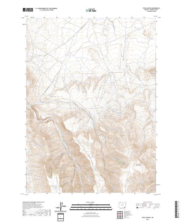
2023 Map of Pole Canyon
USGS Topo · Published 2023About this map
The high desert terrain of the Trout Creek Mountains dominates this portion of Harney County, where water management is the primary marker of human activity on the land. A network of catchments and natural springs, such as Stewart Reservoir Number 1, Lonely Reservoir, and Sheep Camp Spring, indicates a landscape organized around livestock grazing and seasonal water security. The Whitehorse Ranch Rd provides the central artery through this remote basin, skirting the base of Willow Butte and following the drainage of Little Trout Creek. High ridges like Center Ridge and Mahogany Ridge frame deep cuts such as Pole Canyon and Cove Canyon, creating a complex topography of volcanic uplands. This modern survey captures the enduring importance of isolated water sources like Rosebriar Spring and Little Cole Spring in a region where geography is defined by the search for reliable moisture.
Find a feature on this map
28 named features on this map. Tap any name to fly to it.
Don’t see what you’re looking for? This feature index may not catch every label — zoom into the map to look around manually.
Map Details
Editions of this 2023 Pole Canyon Map
This is the sole edition of this map. No revisions or reprints were ever made.
Other maps of this area

1955 · Adel
USGS Topo · 1:250,000

1957 · Adel
USGS Topo · 1:250,000

1958 · Adel
USGS Topo · 1:250,000

1962 · Adel
USGS Topo · 1:250,000
1980 · Windy Point
USGS Topo · 1:24,000
1981 · Little Whitehorse Creek
USGS Topo · 1:24,000
1981 · Red Mountain
USGS Topo · 1:24,000
1981 · Chicken Spring
USGS Topo · 1:24,000
1981 · Red Lookout Butte
USGS Topo · 1:24,000
1981 · Trout Creek Canyon
USGS Topo · 1:24,000