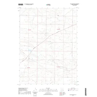
2017 Map of Pole Creek Ranch
USGS Topo · Published 2017About this map
Pole Creek Ranch sits at the heart of this Laramie County landscape, where the high plains of Wyoming meet the headwaters of the Lodgepole Creek system. The terrain is defined by wide seasonal drainages and draws, most notably Antelope Draw in the north and the meandering path of Lodgepole Cr in the south. The area’s ranching character is reinforced by a steady network of named rural routes and secondary roads, including Torrington Rd, which cuts diagonally across the township lines of t16n r66w and t16n r65w. Water management for livestock and irrigation is visible through features like the Pole Cr Reservoir, illustrating how this semi-arid environment was adapted for agricultural use. The map provides a clear view of the section-line road system, including Jay Rd and Divide Rd, which remain vital for local navigation and property demarcation in this expansive cattle country.
Find a feature on this map
19 named features on this map. Tap any name to fly to it.
Don’t see what you’re looking for? This feature index may not catch every label — zoom into the map to look around manually.
Map Details
Editions of this 2017 Pole Creek Ranch Map
This is the sole edition of this map. No revisions or reprints were ever made.
Other maps of this area

1911 · Cheyenne
USGS Topo · 1:125,000

1914 · Cheyenne
USGS Topo · 1:125,000

1950 · Cheyenne
USGS Topo · 1:62,500

1954 · Cheyenne
USGS Topo · 1:250,000

1958 · Cheyenne
USGS Topo · 1:250,000

1961 · Cheyenne
USGS Topo · 1:62,500

1961 · Cheyenne North
USGS Topo · 1:24,000

1962 · P O Ranch
USGS Topo · 1:24,000

1962 · Lewis Ranch
USGS Topo · 1:24,000

1963 · Little Indian Draw
USGS Topo · 1:24,000