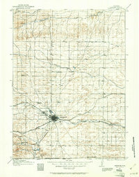
1961 Map of Cheyenne
USGS Topo · Published 1964About this map
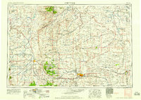
Cheyenne sits at the heart of this early 1960s landscape, serving as a critical hub for both military operations and interstate transportation. The northern reaches of the city are defined by the expansive Francis E Warren Air Force Base, while the Union Pacific Railroad and the C B & Q lines converge at the city center, illustrating the enduring importance of the rail economy. Beyond the urban grid, the map details a sophisticated network of water management, including the Southern Aqueduct and the Colorado Aqueduct, which support the outlying cattle ranches and experimental agricultural sites like the USDA Horticultural Field Station. From the heights of Stevenson Hill to the suburban developments of Orchard Valley, the sheet documents the transition from a historic frontier post to a modern state capital. Researchers can find numerous family-named landmarks such as Carpenter Ranch and Belvoir Ranch dotting the plains.
Find a feature on this map
87 named features on this map. Tap any name to fly to it.
Don’t see what you’re looking for? This feature index may not catch every label — zoom into the map to look around manually.
Map Details
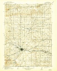
Editions of this 1961 Cheyenne Map
This is the sole edition of this map. No revisions or reprints were ever made.
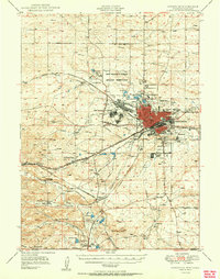
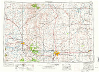
Historical Maps of Cheyenne Through Time
7 maps found