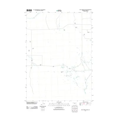
2011 Map of Pole Creek Valley
USGS Topo · Published 2011About this map
The Niobrara River flows across the northern edge of this Nebraska landscape, where the ranching heritage of Cherry County is documented through a dense network of family-named holdings. Settlement patterns here follow the water, with cattle operations concentrated around the Pole Creek Valley and the surrounding drainage. The geography is defined by a series of significant family estates, including the Frank Timm Ranch, Albert Timm Ranch, and Walter Timm Ranch to the west, while the Knight Ranch and Mishler Ranch anchor the central valley.
Find a feature on this map
17 named features on this map. Tap any name to fly to it.
Don’t see what you’re looking for? This feature index may not catch every label — zoom into the map to look around manually.
Map Details
Editions of this 2011 Pole Creek Valley Map
This is the sole edition of this map. No revisions or reprints were ever made.
Other maps of this area

1950 · Irwin
USGS Topo · 1:62,500

1951 · Irwin
USGS Topo · 1:62,500

1951 · Gypsy Valley
USGS Topo · 1:62,500

1955 · Alliance
USGS Topo · 1:250,000

1957 · Alliance
USGS Topo · 1:250,000

1957 · Valentine
USGS Topo · 1:250,000

1958 · Alliance
USGS Topo · 1:250,000

1959 · Valentine
USGS Topo · 1:250,000
1969 · Gordon SE
USGS Topo · 1:24,000
1969 · Rushville 4 NE
USGS Topo · 1:24,000