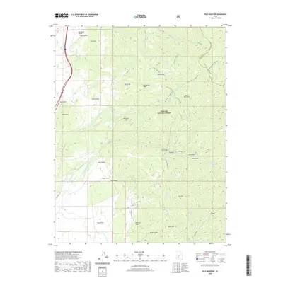
2020 Map of Pole Mountain
USGS Topo · Published 2020About this map
The Tushar Mountains dominate this high-altitude landscape within the Fishlake National Forest, where the complex drainage systems of Piute Co and Beaver County converge. The topography is defined by significant elevations like Pole Mtn and Tanner Mtn, punctuated by a series of named hollows such as Bell Spring Hollow and Mud Spring Hollow. Of particular interest to local historians and those studying land use are the water management features, including the Munderfield Ditch and the Old Munderfield Ditch, which trace the history of irrigation and water rights in this arid environment. The map details a network of high-country trails, including Trail 3589 and Trail 3591, providing a record of access routes through the Red Butte Hills and across the Wildcat Pass. Natural springs like Cold Spring and Drag Hollow Spring mark the essential water sources that have supported livestock and transit through these peaks for generations.
Find a feature on this map
49 named features on this map. Tap any name to fly to it.
Don’t see what you’re looking for? This feature index may not catch every label — zoom into the map to look around manually.
Map Details
Editions of this 2020 Pole Mountain Map
This is the sole edition of this map. No revisions or reprints were ever made.
Other maps of this area

1885 · Beaver
USGS Topo · 1:250,000

1932 · Sevier
USGS Topo · 1:62,500

1935 · Sevier
USGS Topo · 1:62,500

1937 · Delano Peak
USGS Topo · 1:48,000

1943 · Delano Peak
USGS Topo · 1:62,500

1953 · Richfield
USGS Topo · 1:250,000

1954 · Beaver SE
USGS Topo · 1:24,000

1954 · Beaver NE
USGS Topo · 1:24,000

1958 · Richfield
USGS Topo · 1:250,000

1958 · Beaver
USGS Topo · 1:62,500