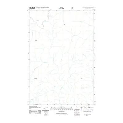
2011 Map of Pole Mountain
USGS Topo · Published 2011About this map
Pole Mountain and Surveyors Peak anchor this high-elevation terrain in Shoshone County, where the hydrological network defines the landscape through numerous drainages. The map traces the upper reaches of several water systems, including Pole Creek, Collins Creek, and Ruby Creek, which carve deep paths through the mountainous relief. To the west, the Surveyors Ridge Rd provides access along the high ground, connecting to St Joe Nf Rd 201 near the northern boundary. Small alpine water bodies, specifically Cliff Lake, Slide Lake, and Steve Lake, are concentrated in the southwest corner near Avalanche Ridge. This layout reflects a wilderness area primarily managed for forest resources and watershed protection, with limited infrastructure centered on Forest Service access routes like Surveyors Ridge Rd.
Find a feature on this map
26 named features on this map. Tap any name to fly to it.
Don’t see what you’re looking for? This feature index may not catch every label — zoom into the map to look around manually.
Map Details
Editions of this 2011 Pole Mountain Map
This is the sole edition of this map. No revisions or reprints were ever made.
Other maps of this area

1911 · Lolo
USGS Topo · 1:250,000

1913 · Lolo
USGS Topo · 1:250,000

1914 · Avery
USGS Topo · 1:125,000

1917 · Avery
USGS Topo · 1:125,000

1918 · St Regis
USGS Topo · 1:125,000

1919 · St. Regis
USGS Topo · 1:125,000

1923 · Washington Creek
USGS Topo · 1:125,000

1956 · Wallace
USGS Topo · 1:250,000

1956 · Hamilton
USGS Topo · 1:250,000

1957 · Simmons Peak
USGS Topo · 1:62,500