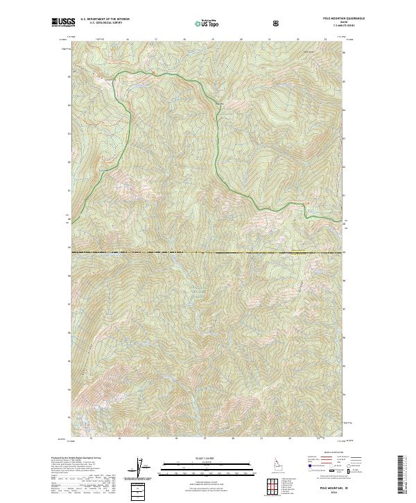
2024 Map of Pole Mountain
USGS Topo · Published 2024About this map
St Joe National Forest and Clearwater National Forest meet along a remote drainage divide in northern Idaho, defined by high peaks and an intricate network of backcountry trails. The landscape is anchored by Pole Mountain and Surveyors Peak, with steep slopes descending toward Scribner Falls and the headwaters of numerous creeks including Timber Creek and Collins Creek. This modern survey illustrates the enduring wilderness character of the Bitterroot Mountains region, where movement is dictated by ridgelines like Surveyors Ridge and Avalanche Ridge. High-elevation water bodies such as Slide Lake, Steve Lake, and Cliff Lake occupy the southwestern reaches, while an established trail system, including the Sawtooth Creek Trail and Pole Mountain Trail, provides the primary means of navigating this roadless interior. The boundary between Shoshone and Clearwater counties bisects the quadrangle, marking the transition between these two massive forest preserves.
Find a feature on this map
38 named features on this map. Tap any name to fly to it.
Don’t see what you’re looking for? This feature index may not catch every label — zoom into the map to look around manually.
Map Details
Editions of this 2024 Pole Mountain Map
This is the sole edition of this map. No revisions or reprints were ever made.
Other maps of this area

1911 · Lolo
USGS Topo · 1:250,000

1913 · Lolo
USGS Topo · 1:250,000

1914 · Avery
USGS Topo · 1:125,000

1917 · Avery
USGS Topo · 1:125,000

1918 · St Regis
USGS Topo · 1:125,000

1919 · St. Regis
USGS Topo · 1:125,000

1923 · Washington Creek
USGS Topo · 1:125,000

1956 · Wallace
USGS Topo · 1:250,000

1956 · Hamilton
USGS Topo · 1:250,000

1957 · Simmons Peak
USGS Topo · 1:62,500