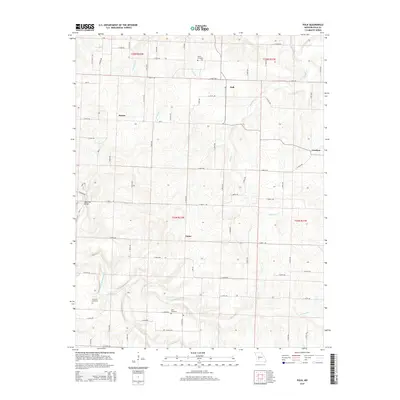
2015 Map of Polk
USGS Topo · Published 2015About this map
Polk and its surrounding agricultural crossroads anchor this 2015 survey of the Missouri landscape north of Halfway. The terrain is defined by the winding course of the Pomme de Terre River in the southwest and the many drainage systems that carve the land, including Panther Cr and Hominy Cr. Small, long-standing settlements like Huron, Violet, and Goodson are connected by a dense network of lettered and numbered rural roads, reflecting a resilient pattern of Ozark farm life. Genealogists will find several burial grounds identified, such as Payne Cemetery, Dunaway Cemetery, and Goff Cemetery, while the Jefferson Bridge marks a specific crossing point over the river. This map provides a clear view of the township and range divisions, specifically where t35n r22w and t34n r22w meet, helping to pin down precise historic land tracts.
Find a feature on this map
60 named features on this map. Tap any name to fly to it.
Don’t see what you’re looking for? This feature index may not catch every label — zoom into the map to look around manually.
Map Details
Editions of this 2015 Polk Map
This is the sole edition of this map. No revisions or reprints were ever made.
Other maps of this area

1884 · Bolivar
USGS Topo · 1:125,000

1892 · Bolivar
USGS Topo · 1:125,000

1942 · Elkton
USGS Topo · 1:24,000

1949 · Elkton
USGS Topo · 1:24,000

1949 · Sentinel
USGS Topo · 1:24,000

1950 · Elkton
USGS Topo · 1:24,000

1950 · Sentinel
USGS Topo · 1:24,000

1950 · Buffalo NW
USGS Topo · 1:24,000

1950 · Polk
USGS Topo · 1:24,000

1950 · Urbana
USGS Topo · 1:24,000