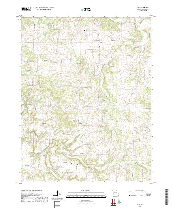
2021 Map of Polk
USGS Topo · Published 2021About this map
The Pomme de Terre River meanders through the southwest corner of this Polk County landscape, which is defined by a dense network of creeks including Panther Cr, Hominy Cr, and the colorfully named Stinking Cr. Small agricultural settlements like Huron, Goodson, Violet, and Halfway serve as anchor points across the undulating terrain. A traveler crossing the river in the west would pass over Jefferson Bridge, while those navigating the backcountry roads would encounter historic burial grounds such as Payne Cem, Dunaway Cem, and Goff Cem. The area is tightly gridded by county roads, yet the topography remains dominant, with numerous branches like Claude Br and Davis Cr carving into the upland Missouri soil. This 2021 survey provides a clear view of the modern rural infrastructure and natural drainage patterns of the Polk quadrangle.
Find a feature on this map
58 named features on this map. Tap any name to fly to it.
Don’t see what you’re looking for? This feature index may not catch every label — zoom into the map to look around manually.
Map Details
Editions of this 2021 Polk Map
This is the sole edition of this map. No revisions or reprints were ever made.
Other maps of this area

1884 · Bolivar
USGS Topo · 1:125,000

1892 · Bolivar
USGS Topo · 1:125,000

1942 · Elkton
USGS Topo · 1:24,000

1949 · Elkton
USGS Topo · 1:24,000

1949 · Sentinel
USGS Topo · 1:24,000

1950 · Elkton
USGS Topo · 1:24,000

1950 · Sentinel
USGS Topo · 1:24,000

1950 · Buffalo NW
USGS Topo · 1:24,000

1950 · Polk
USGS Topo · 1:24,000

1950 · Urbana
USGS Topo · 1:24,000