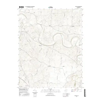
2016 Map of Polkville
USGS Topo · Published 2016About this map
The Barren River snakes through the center of this rural Kentucky landscape, defining the character of small unincorporated communities like Gotts, Hardcastle, and Polkville. The terrain is marked by the winding river valley and its tributary, Bays Fork, which forms part of the southern boundary between Warren and Allen Counties. For local historians and genealogists, the map identifies several family-named burial sites including Kimbrough Cem, Petty Cem, Thomas Cem, and Gilmore Cem, which serve as vital markers of the area's early settlement patterns. Scattered homes and farmsteads are connected by a network of local routes such as Hunts Bend Rd and Iron Bridge Rd, the latter leading to the landmark Iron Bridge. The layout of Greenhill and Motley in the south further illustrates the persistent rural density that characterizes this portion of the Bowling Green region.
Find a feature on this map
72 named features on this map. Tap any name to fly to it.
Don’t see what you’re looking for? This feature index may not catch every label — zoom into the map to look around manually.
Map Details
Editions of this 2016 Polkville Map
This is the sole edition of this map. No revisions or reprints were ever made.
Other maps of this area

1921 · Bowling Green
USGS Topo · 1:62,500

1922 · Brownsville
USGS Topo · 1:62,500

1922 · Mammoth Cave
USGS Topo · 1:62,500

1923 · Bowling Green
USGS Topo · 1:62,500

1923 · Mammoth Cave
USGS Topo · 1:62,500

1923 · Brownsville
USGS Topo · 1:62,500

1926 · Scottsville
USGS Topo · 1:62,500

1954 · Evansville
USGS Topo · 1:250,000

1954 · Bowling Green North
USGS Topo · 1:24,000

1954 · Drake
USGS Topo · 1:24,000