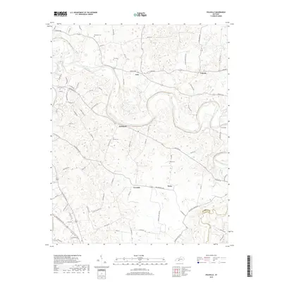
2019 Map of Polkville
USGS Topo · Published 2019About this map
The Barren River winds through the rural landscape of Warren and Allen Counties in this 2019 survey, defining a terrain of deep meanders and alluvial lowlands. Small agricultural communities such as Polkville, Hardcastle, and Gotts are scattered along the ridge tops and valley floors, connected by a network of local roads including Porter Pike and Cemetery Rd. The map reveals a high density of family and community burial grounds, such as Kimbrough Cem, Petty Cem, and Gilmore Cem, which serve as vital markers for local genealogical research.
Find a feature on this map
82 named features on this map. Tap any name to fly to it.
Don’t see what you’re looking for? This feature index may not catch every label — zoom into the map to look around manually.
Map Details
Editions of this 2019 Polkville Map
This is the sole edition of this map. No revisions or reprints were ever made.
Other maps of this area

1921 · Bowling Green
USGS Topo · 1:62,500

1922 · Brownsville
USGS Topo · 1:62,500

1922 · Mammoth Cave
USGS Topo · 1:62,500

1923 · Bowling Green
USGS Topo · 1:62,500

1923 · Mammoth Cave
USGS Topo · 1:62,500

1923 · Brownsville
USGS Topo · 1:62,500

1926 · Scottsville
USGS Topo · 1:62,500

1954 · Evansville
USGS Topo · 1:250,000

1954 · Bowling Green North
USGS Topo · 1:24,000

1954 · Drake
USGS Topo · 1:24,000