
2020 Map of Pollard
USGS Topo · Published 2020About this map
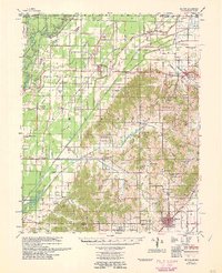
Pollard sits at a geographic transition point where the flat alluvial plains of the Mississippi Embayment meet the distinct elevation of Crowleys Ridge. This 2020 survey illustrates the sharp contrast between the heavily ditched and channelized drainage systems to the north, such as Ditch Number 6 and Fish Loop Slough, and the winding natural watercourses like Housman Cr and Big Cr that flow through the southern uplands. For genealogists, the map identifies several local burial sites, including Crockett Cem near the settlement of Crockett, as well as Cummings Cem and Rogers Cem. The landscape is a patchwork of agricultural drainage and varied terrain, supporting small communities and infrastructure like the Ark-Mo Airport right along the Missouri border.
Find a feature on this map
74 named features on this map. Tap any name to fly to it.
Don’t see what you’re looking for? This feature index may not catch every label — zoom into the map to look around manually.
Map Details
Editions of this 2020 Pollard Map
This is the sole edition of this map. No revisions or reprints were ever made.
Other maps of this area

1935 · Rector
USGS Topo · 1:62,500

1935 · Harviell
USGS Topo · 1:62,500

1940 · Valley Ridge
USGS Topo · 1:62,500

1940 · Piggott
USGS Topo · 1:62,500

1956 · Valley Ridge
USGS Topo · 1:62,500

1956 · Piggott
USGS Topo · 1:62,500

1957 · Poplar Bluff
USGS Topo · 1:250,000

1958 · Rector
USGS Topo · 1:62,500

1959 · Poplar Bluff
USGS Topo · 1:250,000
1960 · Rector
USGS Topo · 1:62,500