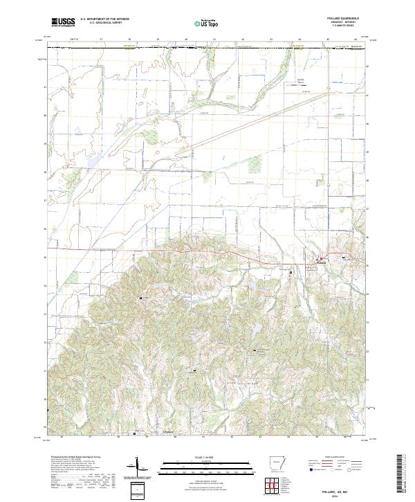
2024 Map of Pollard
USGS Topo · Published 2024About this map
Crowleys Ridge rises distinctly from the surrounding flatlands on this survey of northeastern Arkansas, creating a geological and social divide that dictates the local landscape. The settlement of Pollard sits on higher ground at the edge of this ridge, while the northern sections of the map are defined by an extensive drainage system, including Ditch Number 5 and Fish Trap Slough, which allowed for the conversion of wetlands into productive farmland. Genealogists will find a wealth of local burial sites documenting the area's early families, such as Crockett Cem, Holcomb Cem, and Rogers Cem. The transition from the alluvial plain to the ridgeline is marked by numerous small waterways like Sales Creek and Horse Creek, showing how the topography shaped the placement of roads and small communities like Crockett and its associated Hardin Cem.
Find a feature on this map
77 named features on this map. Tap any name to fly to it.
Don’t see what you’re looking for? This feature index may not catch every label — zoom into the map to look around manually.
Map Details
Editions of this 2024 Pollard Map
This is the sole edition of this map. No revisions or reprints were ever made.
Other maps of this area

1935 · Rector
USGS Topo · 1:62,500

1935 · Harviell
USGS Topo · 1:62,500

1940 · Valley Ridge
USGS Topo · 1:62,500

1940 · Piggott
USGS Topo · 1:62,500

1956 · Valley Ridge
USGS Topo · 1:62,500

1956 · Piggott
USGS Topo · 1:62,500

1957 · Poplar Bluff
USGS Topo · 1:250,000

1958 · Rector
USGS Topo · 1:62,500

1959 · Poplar Bluff
USGS Topo · 1:250,000
1960 · Rector
USGS Topo · 1:62,500