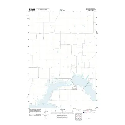
2011 Map of Pollock
USGS Topo · Published 2011About this map
Pollock stands as the primary hub of this landscape along the eastern shores of Lake Pocasse, where the town's grid of streets like Oahe St and Summit Rd meets the water's edge. The surrounding terrain is defined by the drainage of Decker Creek into the lake and the broad expanse of Kenel Flats to the southwest. This 2011 survey illustrates a region shaped by modern water management and agriculture, with a meticulous section-line road network including 100th St SE and 294th Ave carving the prairie into distinct plots. Genealogy researchers can find significant local landmarks such as Spring Valley Cemetery north of the town and LaGrace Cemetery tucked near the shoreline, providing essential points of reference for tracing family roots in Campbell County.
Find a feature on this map
34 named features on this map. Tap any name to fly to it.
Don’t see what you’re looking for? This feature index may not catch every label — zoom into the map to look around manually.
Map Details
Editions of this 2011 Pollock Map
This is the sole edition of this map. No revisions or reprints were ever made.
Other maps of this area

1953 · McIntosh
USGS Topo · 1:250,000

1954 · Bismarck
USGS Topo · 1:250,000

1958 · Bismarck
USGS Topo · 1:250,000

1958 · McIntosh
USGS Topo · 1:250,000

1965 · Herreid NW
USGS Topo · 1:24,000

1965 · Herreid SW
USGS Topo · 1:24,000

1965 · Pollock SE
USGS Topo · 1:24,000

1965 · Pollock
USGS Topo · 1:24,000

1966 · Kenel
USGS Topo · 1:24,000

1966 · Pollock NW
USGS Topo · 1:24,000