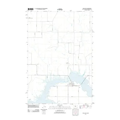
2012 Map of Pollock
USGS Topo · Published 2012About this map
Pollock sits at the northern reaches of Lake Oahe, where the Missouri River valley was transformed by mid-century damming. This 2012 survey illustrates a landscape dominated by the water, showing the town situated between the expansive reservoir and Lake Pocasse to the east. The terrain is characterized by the winding path of Decker Cr and a rigid grid of rural roads like 100th St SE and 295th Ave. For those researching family history in Campbell County, the map identifies local landmarks including Spring Valley Cem to the north and LaGrace Cem near the southern shoreline. The presence of the Vander Wal Private Airport reflects the continued importance of aviation in this sparsely populated prairie region, where agriculture and the managed waterway shape the local economy.
Find a feature on this map
35 named features on this map. Tap any name to fly to it.
Don’t see what you’re looking for? This feature index may not catch every label — zoom into the map to look around manually.
Map Details
Editions of this 2012 Pollock Map
This is the sole edition of this map. No revisions or reprints were ever made.
Other maps of this area

1953 · McIntosh
USGS Topo · 1:250,000

1954 · Bismarck
USGS Topo · 1:250,000

1958 · Bismarck
USGS Topo · 1:250,000

1958 · McIntosh
USGS Topo · 1:250,000

1965 · Herreid NW
USGS Topo · 1:24,000

1965 · Herreid SW
USGS Topo · 1:24,000

1965 · Pollock SE
USGS Topo · 1:24,000

1965 · Pollock
USGS Topo · 1:24,000

1966 · Kenel
USGS Topo · 1:24,000

1966 · Pollock NW
USGS Topo · 1:24,000