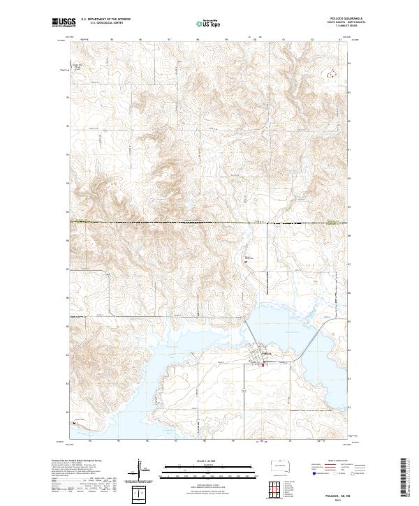
2021 Map of Pollock
USGS Topo · Published 2021About this map
Pollock sits at the northern edge of South Dakota, positioned where the high plains meet the intricate shorelines created by the impoundment of the Missouri River. This landscape is defined by the massive reach of Lake Oahe, which carves the terrain into deep inlets like Pollock Bay and Vanderlaan Bay. The town itself is centered near Lake Pocasse, with local life structured around roads like Summit Rd and Lakeview Dr. Evidence of earlier rural settlement remains in the presence of Spring Valley Cem to the north and LaGrace Cem near the riverbanks. The map also records the jurisdictional transition at the North Dakota South Dakota state line and the Emmons Co Campbell Co border, illustrating how political boundaries intersect with the natural drainage of Decker Cr.
Find a feature on this map
27 named features on this map. Tap any name to fly to it.
Don’t see what you’re looking for? This feature index may not catch every label — zoom into the map to look around manually.
Map Details
Editions of this 2021 Pollock Map
This is the sole edition of this map. No revisions or reprints were ever made.
Other maps of this area

1953 · McIntosh
USGS Topo · 1:250,000

1954 · Bismarck
USGS Topo · 1:250,000

1958 · Bismarck
USGS Topo · 1:250,000

1958 · McIntosh
USGS Topo · 1:250,000

1965 · Herreid NW
USGS Topo · 1:24,000

1965 · Herreid SW
USGS Topo · 1:24,000

1965 · Pollock SE
USGS Topo · 1:24,000

1965 · Pollock
USGS Topo · 1:24,000

1966 · Kenel
USGS Topo · 1:24,000

1966 · Pollock NW
USGS Topo · 1:24,000