
1965 Map of Pollock
USGS Topo · Published 1967About this map
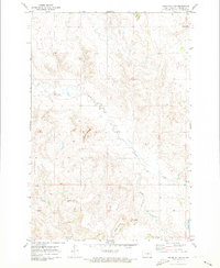
Pollock sits at the intersection of a transformed landscape where the Soo Line railroad meets the expansive waters of the Oahe Reservoir. This mid-1960s survey captures the area just after the Missouri River's damming, showing the town positioned on a peninsula between the reservoir and Pocasse Lake. The topographic detail reveals the stark contrast between the inundated lowlands and the higher prairie ground, which is dotted with rural landmarks like Spring Valley Cem to the north and La Grace Cem to the southwest. The state line between North Dakota and South Dakota runs through the upper third of the map, marking the boundary between Emmons and Campbell counties. Local infrastructure, including a Gravel Pit and Sewage Disposal Ponds, provides evidence of the town's mid-century development and utility management during this era of significant hydrological change.
Find a feature on this map
12 named features on this map. Tap any name to fly to it.
Don’t see what you’re looking for? This feature index may not catch every label — zoom into the map to look around manually.
Map Details
Editions of this 1965 Pollock Map
This is the sole edition of this map. No revisions or reprints were ever made.
Other maps of this area

1953 · McIntosh
USGS Topo · 1:250,000

1954 · Bismarck
USGS Topo · 1:250,000

1958 · Bismarck
USGS Topo · 1:250,000

1958 · McIntosh
USGS Topo · 1:250,000

1965 · Herreid NW
USGS Topo · 1:24,000

1965 · Herreid SW
USGS Topo · 1:24,000

1965 · Pollock SE
USGS Topo · 1:24,000

1966 · Kenel
USGS Topo · 1:24,000

1966 · Pollock NW
USGS Topo · 1:24,000
1971 · Kiefer Buttes
USGS Topo · 1:24,000