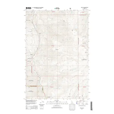
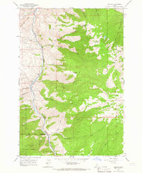
2013 Map of Pollock
USGS Topo · Published 2013About this map
The Little Salmon River corridor carves a deep path through this 2013 survey of the Idaho high country, defining the primary route of transport and settlement. Small communities like Pollock and Pinehurst occupy the valley floor, while Gotzinger sits at a transition point where the canyon walls begin to steepen. The landscape is characterized by significant elevation changes, with White Bird Ridge to the west and peaks such as Indian Mtn and Sheep Mtn rising to the east.
Find a feature on this map
54 named features on this map. Tap any name to fly to it.
Don’t see what you’re looking for? This feature index may not catch every label — zoom into the map to look around manually.
Map Details
Editions of this 2013 Pollock Map
This is the sole edition of this map. No revisions or reprints were ever made.
Other maps of this area

1938 · Riggins
USGS Topo · 1:96,000

1945 · Riggins
USGS Topo · 1:125,000

1955 · Grangeville
USGS Topo · 1:250,000

1959 · Grangeville
USGS Topo · 1:250,000

1963 · Indian Mountain
USGS Topo · 1:24,000
1963 · Hazard Lake
USGS Topo · 1:24,000
1963 · Pollock Mountain
USGS Topo · 1:24,000
1964 · Patrick Butte
USGS Topo · 1:24,000

1964 · Riggins
USGS Topo · 1:24,000
1964 · Pollock
USGS Topo · 1:24,000