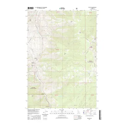
2017 Map of Pollock
USGS Topo · Published 2017About this map
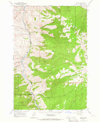
Pollock and Pinehurst sit along the western edge of this 2017 survey, marking the primary human settlements in a landscape dominated by dramatic elevation changes. The Little Salmon River carves a deep valley north-south, serving as the corridor for local roads and the primary drainage for the surrounding highlands. This area represents a significant jurisdictional junction where the Idaho and Adams County line meets the boundaries of two major federal lands: the Payette National Forest and the Nez Perce National Forest. To the east, the terrain rises sharply toward prominent peaks like Indian Mountain and Sheep Mountain. The map details a network of high-altitude features including Dempsey Flat and the curious natural formations of the Devils Ladder and Devils Hole. Smaller water bodies like Elk Lake and numerous creeks such as Rattlesnake Creek emphasize the complex hydrology of this high-country wilderness.
Find a feature on this map
56 named features on this map. Tap any name to fly to it.
Don’t see what you’re looking for? This feature index may not catch every label — zoom into the map to look around manually.
Map Details
Editions of this 2017 Pollock Map
This is the sole edition of this map. No revisions or reprints were ever made.
Other maps of this area

1938 · Riggins
USGS Topo · 1:96,000

1945 · Riggins
USGS Topo · 1:125,000

1955 · Grangeville
USGS Topo · 1:250,000

1959 · Grangeville
USGS Topo · 1:250,000

1963 · Indian Mountain
USGS Topo · 1:24,000
1963 · Hazard Lake
USGS Topo · 1:24,000
1963 · Pollock Mountain
USGS Topo · 1:24,000
1964 · Patrick Butte
USGS Topo · 1:24,000

1964 · Riggins
USGS Topo · 1:24,000
1964 · Pollock
USGS Topo · 1:24,000