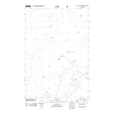
2011 Map of Pollock Mountain
USGS Topo · Published 2011About this map
Black Leopard Discovery Mine sits within a landscape defined by sharp elevation changes and high-altitude outposts near the Rapid River. This survey captures the working character of the region, where livestock infrastructure like Shannon Corral and Campbells Cow Camp is as prominent as the natural terrain. The map documents the network of fire and forestry surveillance at the Pollock Mountain Lookout, positioned high above the Devils Ladder and Cold Springs Saddle. In the southern reaches, recreational and resource-management sites such as Smokey Forest Camp and Star Creek Camp are connected by a system of Forest Service roads including Smokey Boulder Rd. From the waters of Twin Lakes Creek to the heights of North Star Butte, the map provides a look at this part of Idaho as it functioned in the early twenty-first century.
Find a feature on this map
62 named features on this map. Tap any name to fly to it.
Don’t see what you’re looking for? This feature index may not catch every label — zoom into the map to look around manually.
Map Details
Editions of this 2011 Pollock Mountain Map
This is the sole edition of this map. No revisions or reprints were ever made.
Other maps of this area

1920 · Seven Devils Mining District
USGS Topo · 1:48,000

1922 · He Devil
USGS Topo · 1:48,000

1938 · Riggins
USGS Topo · 1:96,000

1945 · Riggins
USGS Topo · 1:125,000

1955 · Grangeville
USGS Topo · 1:250,000

1957 · He Devil
USGS Topo · 1:62,500

1957 · Cuprum
USGS Topo · 1:62,500

1959 · Grangeville
USGS Topo · 1:250,000

1963 · Bally Mountain
USGS Topo · 1:24,000

1963 · Indian Mountain
USGS Topo · 1:24,000