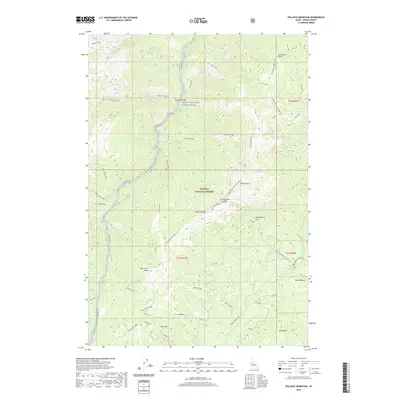
2020 Map of Pollock Mountain
USGS Topo · Published 2020About this map
Pollock Mtn serves as a central landmark within the Payette National Forest, overlooking a landscape defined by dramatic elevation changes and a complex hydrological network. The Rapid Wild and Scenic River flows through the heart of this region, joined by numerous tributaries such as Lonesome Cr and Paradise Creek. This 2020 survey illustrates a wilderness primarily shaped by forestry and conservation, where high-altitude features like North Star Butte and the Devils Ladder ridge provide significant topographic orientation. The map documents the primitive infrastructure of the modern forest, including the Smokey Boulder Rd and forest routes like F RD 158. Notable geographic points such as Chokecherry Flat and Bear Wallow indicate areas of localized importance for forest management and wildlife, reflecting the enduring character of the Idaho backcountry.
Find a feature on this map
60 named features on this map. Tap any name to fly to it.
Don’t see what you’re looking for? This feature index may not catch every label — zoom into the map to look around manually.
Map Details
Editions of this 2020 Pollock Mountain Map
This is the sole edition of this map. No revisions or reprints were ever made.
Other maps of this area

1920 · Seven Devils Mining District
USGS Topo · 1:48,000

1922 · He Devil
USGS Topo · 1:48,000

1938 · Riggins
USGS Topo · 1:96,000

1945 · Riggins
USGS Topo · 1:125,000

1955 · Grangeville
USGS Topo · 1:250,000

1957 · He Devil
USGS Topo · 1:62,500

1957 · Cuprum
USGS Topo · 1:62,500

1959 · Grangeville
USGS Topo · 1:250,000

1963 · Bally Mountain
USGS Topo · 1:24,000

1963 · Indian Mountain
USGS Topo · 1:24,000