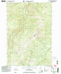
2004 Map of Pollock Mountain
USGS Topo · Published 2007About this map
Pollock Mountain dominates this portion of the Payette National Forest, a landscape defined by sharp elevation changes and the drainages of the Rapid River and Boulder Creek. In the early 2000s, this area remained largely remote, characterized by seasonal camps and historical land-use patterns rather than permanent towns. Human presence is marked by isolated structures like the Paradise Cabin and Campbells Cow Camp, alongside a solitary Grave located east of Lonesome Creek. The presence of the Black Leopard Discovery Mine and another Prospect near Indian Springs indicates the persistent interest in mineral extraction within these high basins. Notable landmarks such as the Devils Ladder and Chokecherry Flat provide orientation for those navigating the steep terrain between North Star Butte and Ant Butte.
Find a feature on this map
57 named features on this map. Tap any name to fly to it.
Don’t see what you’re looking for? This feature index may not catch every label — zoom into the map to look around manually.
Map Details
Editions of this 2004 Pollock Mountain Map
This is the sole edition of this map. No revisions or reprints were ever made.
Other maps of this area

1920 · Seven Devils Mining District
USGS Topo · 1:48,000

1922 · He Devil
USGS Topo · 1:48,000

1938 · Riggins
USGS Topo · 1:96,000

1945 · Riggins
USGS Topo · 1:125,000

1955 · Grangeville
USGS Topo · 1:250,000

1957 · He Devil
USGS Topo · 1:62,500

1957 · Cuprum
USGS Topo · 1:62,500

1959 · Grangeville
USGS Topo · 1:250,000

1963 · Bally Mountain
USGS Topo · 1:24,000

1963 · Indian Mountain
USGS Topo · 1:24,000