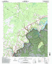
1994 Map of Pollocksville
USGS Topo · Published 1997About this map
The Trent River meanders through the heart of this coastal plain landscape, defining the border between the Croatan National Forest and the developed uplands of Jones and Craven counties. The town of Pollocksville serves as a focal point near the river's bend, where the Pollocksville Elem Sch and local infrastructure support the surrounding rural communities. To the north and east, residential growth is evident in Trent Woods and River Bend, while the vast Great Dover Swamp dominates the northwestern quadrant, highlighting the region's diverse wetland ecology.
Find a feature on this map
40 named features on this map. Tap any name to fly to it.
Don’t see what you’re looking for? This feature index may not catch every label — zoom into the map to look around manually.
Map Details
Editions of this 1994 Pollocksville Map
2 editions found
Other maps of this area

1901 · New Bern
USGS Topo · 1:62,500

1903 · New Bern
USGS Topo · 1:62,500

1903 · Trent River
USGS Topo · 1:62,500

1904 · Trent River
USGS Topo · 1:62,500

1942 · Maysville
USGS Topo · 1:62,500

1943 · Jacksonville
USGS Topo · 1:62,500

1948 · Maysville
USGS Topo · 1:62,500

1950 · Pollocksville
USGS Topo · 1:24,000

1950 · New Bern
USGS Topo · 1:24,000

1953 · Rocky Mount
USGS Topo · 1:250,000