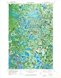
1971 Map of Pomroy
USGS Topo · Published 1973About this map
The Big Fork River meanders through a dense patchwork of timberlands and wetlands at the intersection of Northern Minnesota's major protected wilderness areas. This orthophotomap, based on 1969 and 1970 aerial photography, reveals the remote settlement of Pomroy and the nearby Mission Ch. The landscape is dominated by the overlapping boundaries of the Pine Island State Forest, Big Fork State Forest, and the Chippewa National Forest. The presence of the Winter Road Trail and the Winter Road River suggests the seasonal nature of transportation and logging in this swampy terrain. Hydrological features like Wirt Lake, Spruce Lake, and Noma Lake are clearly visible against the wooded backdrop, alongside named landmarks such as Robbs Rapids on the river. This specific edition provides a clear record of the area's mid-century road network and forest management during a period of active resource utilization.
Find a feature on this map
21 named features on this map. Tap any name to fly to it.
Don’t see what you’re looking for? This feature index may not catch every label — zoom into the map to look around manually.
Map Details
Editions of this 1971 Pomroy Map
This is the sole edition of this map. No revisions or reprints were ever made.
Other maps of this area

1918 · Zora
USGS Topo · 1:62,500

1919 · Zora
USGS Topo · 1:62,500

1919 · Gemmell
USGS Topo · 1:62,500

1919 · Max
USGS Topo · 1:62,500

1954 · Bemidji
USGS Topo · 1:250,000

1954 · Hibbing
USGS Topo · 1:250,000

1957 · Bemidji
USGS Topo · 1:250,000

1957 · Hibbing
USGS Topo · 1:250,000

1958 · Bemidji
USGS Topo · 1:250,000

1958 · Hibbing
USGS Topo · 1:250,000