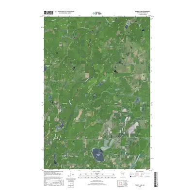
2016 Map of Pomroy Lake
USGS Topo · Published 2016About this map
Snake River meanders through this portion of Kanabec County, defining a landscape of low-lying wetlands and scattered glacial lakes. The southern portion of the map is anchored by Pomroy Lake, with residential development concentrated along N Pine View Beach Rd and S Pine View Beach Rd. To the northwest, the curiously named Lake Full of Fish sits near the confluence of Snowshoe Brook and the river, while McMullen Lake and Peace Lake occupy more isolated positions to the north and east. The region's drainage history is evident in engineered features like County Ditch Number Ten, which cuts through the southeastern wetlands. A network of numbered township roads, such as 360th Ave and Rainbow St, provides a grid for the rural homesteads and agricultural plots that dot the terrain.
Find a feature on this map
37 named features on this map. Tap any name to fly to it.
Don’t see what you’re looking for? This feature index may not catch every label — zoom into the map to look around manually.
Map Details
Editions of this 2016 Pomroy Lake Map
This is the sole edition of this map. No revisions or reprints were ever made.
Other maps of this area

1953 · Duluth
USGS Topo · 1:250,000

1953 · Stillwater
USGS Topo · 1:250,000

1955 · Stillwater
USGS Topo · 1:250,000

1958 · Stillwater
USGS Topo · 1:250,000

1958 · Duluth
USGS Topo · 1:250,000

1961 · Brook Park
USGS Topo · 1:62,500

1965 · Stillwater
USGS Topo · 1:250,000

1968 · Kroschel NW
USGS Topo · 1:24,000

1968 · Mora North
USGS Topo · 1:24,000

1968 · Pomroy Lake
USGS Topo · 1:24,000