
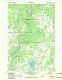
1968 Map of Pomroy Lake
USGS Topo · Published 1970About this map
The Snake River meanders through Kanabec County, defining much of the northern topography with its various rapids and adjacent marshlands. In the late 1960s, this landscape was a mosaic of conservation and recreation areas, including the Snake River State Forest and dedicated wildlife habitats like the Bean Dam State Wildlife Management Area. The central portion of the sheet is characterized by the convergence of smaller water bodies such as Peace Lake and the remarkably named Lake Full of Fish, which feeds into the river system via Snowshoe Brook.
Find a feature on this map
20 named features on this map. Tap any name to fly to it.
Don’t see what you’re looking for? This feature index may not catch every label — zoom into the map to look around manually.
Map Details
Editions of this 1968 Pomroy Lake Map
2 editions found
Other maps of this area

1953 · Duluth
USGS Topo · 1:250,000

1953 · Stillwater
USGS Topo · 1:250,000

1955 · Stillwater
USGS Topo · 1:250,000

1958 · Stillwater
USGS Topo · 1:250,000

1958 · Duluth
USGS Topo · 1:250,000

1961 · Brook Park
USGS Topo · 1:62,500

1965 · Stillwater
USGS Topo · 1:250,000

1968 · Kroschel NW
USGS Topo · 1:24,000

1968 · Mora North
USGS Topo · 1:24,000

1968 · Warman
USGS Topo · 1:24,000