
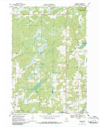
1968 Map of Warman
USGS Topo · Published 1970About this map
Warman sits at the heart of this central Minnesota landscape, where the local economy and land use are shaped by both its natural hydrology and extractive industry. In the late 1960s, the terrain was defined by significant water systems, including the Snake River and Knife River, alongside smaller features like Bean Brook and Snowshoe Lake. The mapping reveals a clear industrial presence with several Quarries and a Gravel Pit located near the settlement, suggesting the importance of stone and aggregate production to the area's development. Large tracts of land are dedicated to conservation, most notably the Hay-Snake State Wildlife Management Area in the northeast. This 1968 survey details a rural township structure including the divisions of Ford, Peace, Hillman, and Hay Brook, reflecting the organized civic layout of Kanabec County at the time.
Find a feature on this map
16 named features on this map. Tap any name to fly to it.
Don’t see what you’re looking for? This feature index may not catch every label — zoom into the map to look around manually.
Map Details
Editions of this 1968 Warman Map
2 editions found
Other maps of this area

1953 · Duluth
USGS Topo · 1:250,000

1953 · Stillwater
USGS Topo · 1:250,000

1955 · Stillwater
USGS Topo · 1:250,000

1958 · Stillwater
USGS Topo · 1:250,000

1958 · Duluth
USGS Topo · 1:250,000

1961 · Brook Park
USGS Topo · 1:62,500

1965 · Stillwater
USGS Topo · 1:250,000

1968 · Ann Lake
USGS Topo · 1:24,000

1968 · Kroschel NW
USGS Topo · 1:24,000

1968 · Isle SW
USGS Topo · 1:24,000