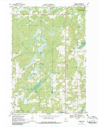
1968 Map of Warman
USGS Topo · Published 1986About this map
Warman and Woodland serve as the primary focal points in this 1960s survey of Kanabec County, where the landscape is defined by an intricate network of wetlands and watercourses. The local extractive industry is evidenced by several Quarries and a Gravel Pit located near the town centers. Significant conservation and water management efforts are visible through the Hay-Snake State Wildlife Management Area and the Spillway Elev 1154 on Knife Lake. The map details a transition from the northern reaches of Hay Creek down to the southern flow of the Snake River and Knife River. This survey captures the rural character of the Peace and Hillman townships before more modern infrastructure changes, preserving the locations of a Radio Tower, Lookout Tower, and the various brooks like Bean Brook and Snowshoe Brook that drain the region's expansive marshlands.
Find a feature on this map
21 named features on this map. Tap any name to fly to it.
Don’t see what you’re looking for? This feature index may not catch every label — zoom into the map to look around manually.
Map Details
Editions of this 1968 Warman Map
2 editions found

Other maps of this area

1953 · Duluth
USGS Topo · 1:250,000

1953 · Stillwater
USGS Topo · 1:250,000

1955 · Stillwater
USGS Topo · 1:250,000

1958 · Stillwater
USGS Topo · 1:250,000

1958 · Duluth
USGS Topo · 1:250,000

1961 · Brook Park
USGS Topo · 1:62,500

1965 · Stillwater
USGS Topo · 1:250,000

1968 · Ann Lake
USGS Topo · 1:24,000

1968 · Kroschel NW
USGS Topo · 1:24,000

1968 · Isle SW
USGS Topo · 1:24,000