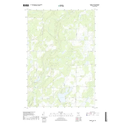
2019 Map of Pomroy Lake
USGS Topo · Published 2019About this map
Pomroy Lake and its surrounding wetlands define this portion of Ford Township, where residential clusters like those along N Pine View Beach Rd and Pomroy Beach Dr meet a landscape heavily shaped by glacial hydrology. The Snake River winds prominently through the western half of the quadrangle, joined by tributaries such as Snowshoe Brook. The presence of County Ditch Number Ten indicates a history of managed drainage to support local land use in this lacustrine environment. Further north, the terrain is dotted with smaller water bodies including McMullen Lake, Peace Lake, and the descriptively named Lake Full of Fish. This contemporary survey reflects the area's modern road network, including Co Rd 3 and Co Rd 5, while maintaining the section lines and township boundaries of the Public Land Survey System.
Find a feature on this map
37 named features on this map. Tap any name to fly to it.
Don’t see what you’re looking for? This feature index may not catch every label — zoom into the map to look around manually.
Map Details
Editions of this 2019 Pomroy Lake Map
This is the sole edition of this map. No revisions or reprints were ever made.
Other maps of this area

1953 · Duluth
USGS Topo · 1:250,000

1953 · Stillwater
USGS Topo · 1:250,000

1955 · Stillwater
USGS Topo · 1:250,000

1958 · Stillwater
USGS Topo · 1:250,000

1958 · Duluth
USGS Topo · 1:250,000

1961 · Brook Park
USGS Topo · 1:62,500

1965 · Stillwater
USGS Topo · 1:250,000

1968 · Kroschel NW
USGS Topo · 1:24,000

1968 · Mora North
USGS Topo · 1:24,000

1968 · Pomroy Lake
USGS Topo · 1:24,000