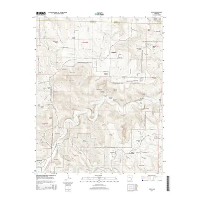
2014 Map of Ponca
USGS Topo · Published 2014About this map
The Buffalo National River carves a deep path through this portion of Newton County, defining a landscape of dramatic vertical relief and secluded drainage basins. Significant limestone and sandstone formations appear as named features along the river corridor, including the massive Roark Bluff, Bee Bluff, and Big Bluff. The settlement of Ponca serves as a western gateway near the junction of Ar-43 and W AR 74 Hwy, while Compton sits on the higher elevations to the northeast. Local history is anchored by several family and community burial grounds such as Grogans Cem, Jones Cem, and Mt Sherman Cem. The network of hollows, such as the famous Hemmed-In Hollow and Fishtrap Hollow, illustrates the complex hydrology of the Ozark Plateau, where numerous small tributaries like Sneeds Cr and Cecil Cr feed the main river system. This survey documents the area as it transitioned into a federally protected wilderness corridor.
Find a feature on this map
120 named features on this map. Tap any name to fly to it.
Don’t see what you’re looking for? This feature index may not catch every label — zoom into the map to look around manually.
Map Details
Editions of this 2014 Ponca Map
This is the sole edition of this map. No revisions or reprints were ever made.
Other maps of this area

1904 · Harrison
USGS Topo · 1:125,000

1905 · Harrison
USGS Topo · 1:125,000

1933 · Mt Judea
USGS Topo · 1:62,500

1940 · Mt Judea
USGS Topo · 1:62,500

1945 · Harrison
USGS Topo · 1:250,000

1949 · Harrison
USGS Topo · 1:250,000

1954 · Harrison
USGS Topo · 1:250,000

1956 · Russellville
USGS Topo · 1:250,000

1958 · Harrison
USGS Topo · 1:250,000

1964 · Russellville
USGS Topo · 1:250,000