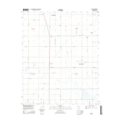
2015 Map of Pond
USGS Topo · Published 2015About this map
San Joaquin Valley agriculture dominates this portion of Kern County, where a rigid grid of rural roads connects several established farming communities. The settlement of Pond sits at the intersection of Pond Rd and Wasco-Pond Rd, serving as a central point for the surrounding fields. To the south, Elmo is positioned along the Elmo Hwy, while the larger centers of Delano and McFarland appear at the northern and eastern margins. The natural hydrology of Poso Creek meanders through the southern landscape, contrasting with the engineered precision of the Callaway Canal. This geography highlights the intensive land use of the Central Valley, where named thoroughfares like Airport Ave and Woollomes Ave define the boundaries of large agricultural tracts and irrigation networks.
Find a feature on this map
45 named features on this map. Tap any name to fly to it.
Don’t see what you’re looking for? This feature index may not catch every label — zoom into the map to look around manually.
Map Details
Editions of this 2015 Pond Map
This is the sole edition of this map. No revisions or reprints were ever made.
Other maps of this area

1927 · McFarland
USGS Topo · 1:31,680

1929 · Delano
USGS Topo · 1:31,680

1929 · Stone
USGS Topo · 1:31,680

1929 · Allensworth
USGS Topo · 1:31,680

1930 · McFarland
USGS Topo · 1:31,680

1930 · Leonards
USGS Topo · 1:31,680

1930 · Hamlin School
USGS Topo · 1:31,680

1930 · Wasco
USGS Topo · 1:31,680

1930 · Pond
USGS Topo · 1:31,680

1930 · Famoso
USGS Topo · 1:31,680