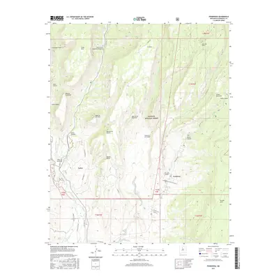
2017 Map of Ponderosa
USGS Topo · Published 2017About this map
The Jemez River and Rio Guadalupe converge amidst the towering plateau country of Sandoval County, defining the high-desert landscape near the settlements of Ponderosa and Cañon. Much of this territory is managed within the Santa Fe National Forest, where the topography is dominated by expansive flat-topped features like Guadalupita Mesa, Virgin Mesa, and San Juan Mesa. This survey illustrates a network of local access roads such as Vista Hermosa Rd and Madrid Rd that serve the canyon floors and mesa edges.
Find a feature on this map
48 named features on this map. Tap any name to fly to it.
Don’t see what you’re looking for? This feature index may not catch every label — zoom into the map to look around manually.
Map Details
Editions of this 2017 Ponderosa Map
This is the sole edition of this map. No revisions or reprints were ever made.
Other maps of this area

1890 · Jemes
USGS Topo · 1:125,000

1892 · Jemes
USGS Topo · 1:125,000

1937 · Jemez Springs
USGS Topo · 1:48,000

1939 · La Ventana
USGS Topo · 1:62,500

1939 · San Ysidro
USGS Topo · 1:62,500

1943 · San Ysidro
USGS Topo · 1:62,500

1943 · Jemez
USGS Topo · 1:62,500

1943 · La Ventana
USGS Topo · 1:62,500

1944 · Jemez Springs
USGS Topo · 1:62,500

1952 · Jemez Springs
USGS Topo · 1:62,500