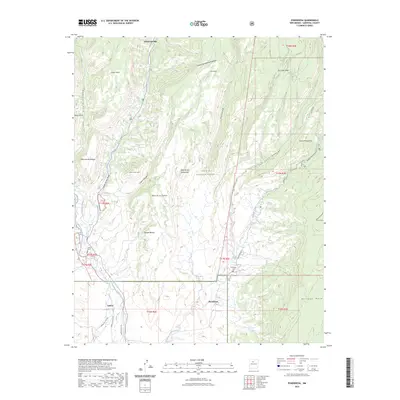
2023 Map of Ponderosa
USGS Topo · Published 2023About this map
Jemez Springs and the village of Ponderosa anchor this high-altitude landscape where deep canyons meet massive volcanic plateaus. The Jemez River carves south through the Cañon de San Diego, paralleled by water management features like the Cañones Community Ditch and the West Side Lateral, reflecting the region's historical reliance on acequias and shared irrigation. High mesa country dominates the topography, from the broad Virgin Mesa in the west to the deeply incised San Juan Canyon to the east. Modern land management by the Santa Fe National Forest encompasses much of the territory, yet the map retains evidence of long-standing local communities. The presence of the Ponderosa Cem and Cañon Cem near the settlement of Cañon provides specific locations for genealogical research and community history within the rugged terrain of the Jemez Mountains.
Find a feature on this map
39 named features on this map. Tap any name to fly to it.
Don’t see what you’re looking for? This feature index may not catch every label — zoom into the map to look around manually.
Map Details
Editions of this 2023 Ponderosa Map
This is the sole edition of this map. No revisions or reprints were ever made.
Other maps of this area

1890 · Jemes
USGS Topo · 1:125,000

1892 · Jemes
USGS Topo · 1:125,000

1937 · Jemez Springs
USGS Topo · 1:48,000

1939 · La Ventana
USGS Topo · 1:62,500

1939 · San Ysidro
USGS Topo · 1:62,500

1943 · San Ysidro
USGS Topo · 1:62,500

1943 · Jemez
USGS Topo · 1:62,500

1943 · La Ventana
USGS Topo · 1:62,500

1944 · Jemez Springs
USGS Topo · 1:62,500

1952 · Jemez Springs
USGS Topo · 1:62,500