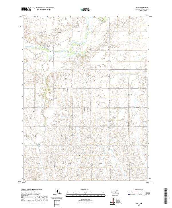
2021 Map of Poole
USGS Topo · Published 2021About this map
Poole sits near the northern banks of the South Loup River in this central Nebraska landscape, where the river's wide, braided channel creates a distinct break in the section-line grid. This modern topographic view shows how the township and range lines of Buffalo County dictate the local infrastructure, with roads like Ravenna Rd and Buckeye Rd following the cardinal directions across the upland terrain. Rural history is preserved through scattered burial grounds, including Majors Cem in the west and Pleasant Ridge Cem further south. The drainage patterns of Cedar Cr and Sweet Cr carve north-south valleys through the plains, eventually feeding into the Loup system. While agriculture dominates the land use, features like the Skochdopole Reservoir highlight local water management and land ownership patterns that have persisted into the twenty-first century.
Find a feature on this map
28 named features on this map. Tap any name to fly to it.
Don’t see what you’re looking for? This feature index may not catch every label — zoom into the map to look around manually.
Map Details
Editions of this 2021 Poole Map
This is the sole edition of this map. No revisions or reprints were ever made.
Other maps of this area

1896 · Kearney
USGS Topo · 1:125,000

1896 · Wood River
USGS Topo · 1:125,000

1899 · Loup
USGS Topo · 1:125,000

1951 · Hazard
USGS Topo · 1:24,000

1953 · Rockville
USGS Topo · 1:24,000

1953 · Ravenna
USGS Topo · 1:24,000

1955 · Broken Bow
USGS Topo · 1:250,000

1955 · Grand Island
USGS Topo · 1:250,000

1956 · Broken Bow
USGS Topo · 1:250,000

1957 · Grand Island
USGS Topo · 1:250,000